ESA Satellites Show How Earth Moved During the Italy Quake
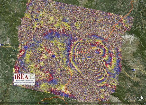
Scientists have analyzed the movement of Earth during and after the 6.3 earthquake that shook the medieval town of L’Aquila in central Italy on 6 April 2009 by studying radar data from ESA’s Envisat and the Italian Space Agency’s COSMO-SkyMed satellites. The scientists used a technique that merged data acquired before and after the earthquake to generate images that appear as rainbow-colored interference patterns. A complete set of colored bands or ‘fringes’ represents ground movement relative to the spacecraft.
Comments:
There are no comments yet.