
Hi folks.
From another trip up to Utah in early April, I've put together a panoramic collage consisting of seven verticle frames spanning roughly 160 degrees.
On the left side (west) is the early settlers community of Fruita, complete with original orchards. That's also the location of the visitors center.
The Fremont River and Highway 24 cut through the towering sandstone of the Waterpocket Fold (north/south), the dominant geological feature of the park.
The turnout in the highway is at a petroglyph site. I've hiked up to the edge of a 1000' cliff and am shooting across the river and highway to the north side.
Hidden in a valley just beyond is the impressive Hickman Natural Bridge. Light colored Navajo sandstone domes cap off the red Wingate sandstone cliffs.
I think this one turned out really well. I hope you like it.
Linton
Just up the road is Panorama Point, where I usually do my observing.
I suppose I should try one of these there.
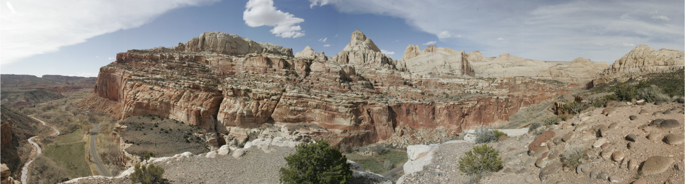
From another trip up to Utah in early April, I've put together a panoramic collage consisting of seven verticle frames spanning roughly 160 degrees.
On the left side (west) is the early settlers community of Fruita, complete with original orchards. That's also the location of the visitors center.
The Fremont River and Highway 24 cut through the towering sandstone of the Waterpocket Fold (north/south), the dominant geological feature of the park.
The turnout in the highway is at a petroglyph site. I've hiked up to the edge of a 1000' cliff and am shooting across the river and highway to the north side.
Hidden in a valley just beyond is the impressive Hickman Natural Bridge. Light colored Navajo sandstone domes cap off the red Wingate sandstone cliffs.
I think this one turned out really well. I hope you like it.
Linton
Just up the road is Panorama Point, where I usually do my observing.
I suppose I should try one of these there.
Attached Image: